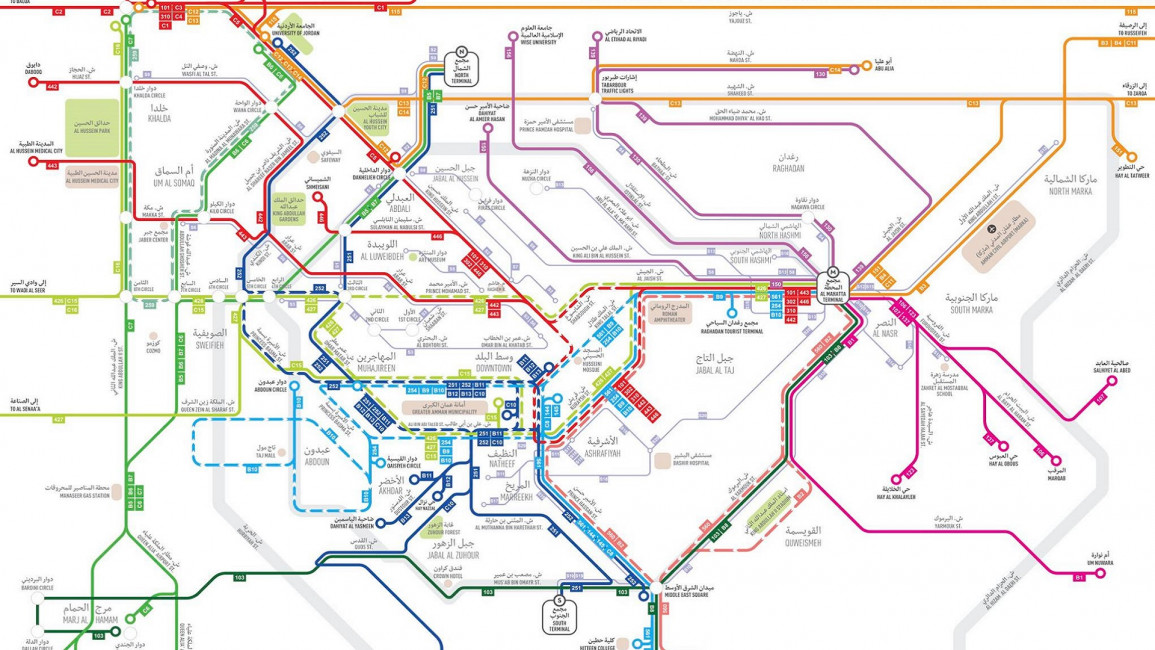
Volunteers launch first Amman public transport map
Volunteers launch first Amman public transport map
A group of citizens in Jordan's capital, relying on data provided by a network of volunteers, have produced an unofficial map of the city's bus and taxi routes
1 min read
The professional-looking map covers most of the routes of the kingdom's sprawling capital [MaanNasel]
A group of Jordanian volunteers have launched an unofficial public transport map for the kingdom's capital Amman.
The citizen-led public transport advocacy group Maan Nasel (Together We Reach) has made the map available on its website complete with an app downloadable for Android and iOS.
The data that went into the map was provided by residents of Amman, to produce routes used by the city's taxis, buses and smaller buses "coasters".
"We finally have a map for public transportation in Amman, Jordan!
"This map helps the residents and visitors of Amman plan their trips using the existing network of buses, coasters and services (taxis)...we encourage you all to join in and feed the map with more routes covering different parts of the city and eventually the whole country," said the announcement on Maan Nasel's website.
Until now, no such information was available to commuters in the Jordanian capital, where public transport has often been criticised as inadequate.
The move was welcome news to many in Jordan.
Hazem Zureiqat, transport consultant and founding member of Maan Nasel, praised the first step and called on the public to share feedback to help improve the map.
The map can be downloaded here.
| Facebook Post |
| Facebook Post |


